

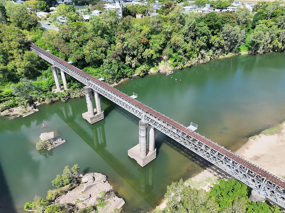
Pioneer River Rail Bridge
Structural Inspection
5644
4k images
Used to generate a high-quality, photogrammetric model to document the asset condition.
90 min
Flight time
Needed to collect all required visual data.
270m
Bridge Length
Total bridge length spanning across the Pioneer River
890
Notable Defects
Defects requiring monitoring or maintenance actions.

History
This bridge has so much history, it would've been disrespectful to not share it here. So here's an overview. Credits to Pioneer Valley Museum in Mirani for sharing all of this info online.
-
1895 - QLD Government approves budget $34,000 to build rail bridge over Pioneer River at Mirani
-
1896 - Construction begins
-
1897 - Mackay declares public holiday for the testing of the bridge. 2000 people from around the region attend.
-
1891 to 1956 - Passenger trains run from the base of the Eungella Range all the way into Mackay via the original bridge, providing children with access to secondary education.
-
1956 - Bridge is swept away by flood waters
-
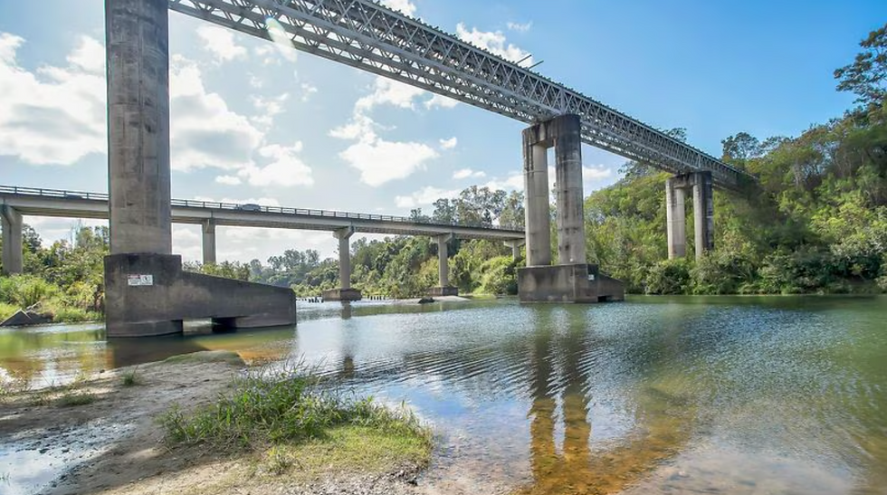
1959 - New bridge is built taller and stronger than the original.
The image to the left shows the construction of the new bridge, 20 metres upstream of where the orginal once stood. Wreckage from the original bridge is still visible to this day from nearby Platypus Beach.
Insite took great pleasure in applying our state-of-the-art inspection process to monitor the condition of this historical bridge.
Our Process
Every Insite inspection follows the same proven workflow. From automated data capture through to an engineering defect report. Full coverage, full detail.
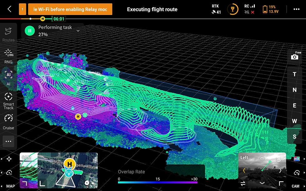
Automated Flight Route Mapping
The drone performs an initial automated scan of the asset, building a real-time 3D mesh of the bridge and surrounding terrain and obstacles.
That mesh is used to generate a precise flight path around the entire bridge. accounting for tress, water, and complex geometry.
Every surface is located before detailed capture begins.
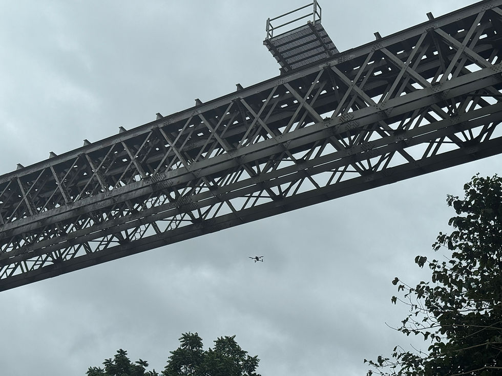
Automated Data Collection
The drone executes the planned route autonomously, capturing thousands of high-resolution images in a single flight.
Each battery last 30 to 45 minutes. When the battery is low the drone returns home, battery is replaced and off it goes to continue the mission.
The camera rotates to take photos at every angle, providing unmatched coverage of complex structures like the lattice steel structure of this bridge.
No scaffolding or access equipment required.

Processing
For this inspection, the drone captured 5644 images. All in 4k resolution.
This data is fed into Metashape, which produced a point cloud of around 2.5 million points. The software then computes surfaces and textures from the images to produce a high-accuracy, high-quality photogrammetric model.

Reporting
The model provides all the visual data an engineer needs to remotely inspect the bridge and identify structural defects.
Insite carefully interrogates the model to compile a comprehensive list of defects, along with their severity and risk scores.
Every defect is is located on a 'Defect Markup' drawing package. This provides maintenance team with the information they need to plan effectively.
Photogrammetric Model
The 3D model is the perfect visual, digital representation of the bridge when it was inspected. Check out a scaled down version of the model for yourself below.
Key Lessons
Insite successfully completed the condition assessment of the Pioneer River rail bridge at Mirani, but it wasn't without our fair share of struggles and mistakes. Here's what we learnt:

Multiple Passes on High Detail Areas
The complexity of the steel lattice section of this bridge makes it difficult to capture interior braces. The model could be improved by doing a seperate, second pass over these high detail areas.
Pre-Mobilisation Preparation
Drones and their remote controllers don't operate if their software isn't fully updated. I learnt this a bit too late. From now on, all software updates are completed the day before the flight.
Monitor Weather Closely
Drones don't do well in rain. And images aren't as clear in overcast lighting.
Results work best when the weather is clear.