
2026
18x Lighting Towers
18x stockpile lighting towers, 3 different designs, full structural data captured in just 3 days.
Data Capture
Digital Twin
Overview
57,644 4k images
55m tall towers
3 days of flight time

About The Project
Insite was engaged by a structural engineering consultancy to capture and process condition data across 18 high-mast lighting towers at a major coal terminal in Gladstone.
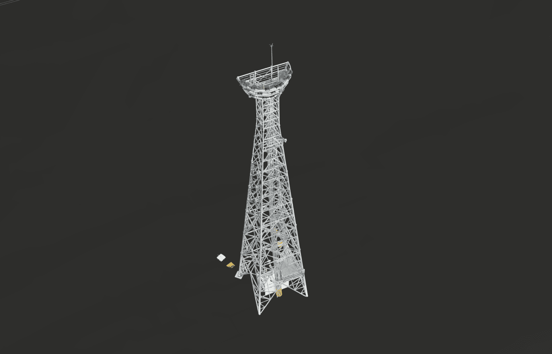
Each tower was inspected using the DJI Matrice 4 series drone, capturing full overage from base to top at high resolution — every connection and structural member documented in detail no EWP inspection could replicate at this scale.
Each tower was delivered as a photogrammetric digital twin, published to an interactive 3D web scene. The client received more than 57,000 4K structural images to build their inspection report.
Insite is extremely proud of the outcomes and value we were able to provide to our client.

Comparison
To do the same inspection using traditional methods would have taken alot more time, cost more and yielded worse results. We ran the numbers on a comparison between the drone-based inspection and the same inspection using an EWP:
Time Saving - 7 Days
Structural data of each tower was captured in just 30 minutes.
Cost Saving: $40,000+
No EWP, spotter or permits required.
Better Quality: Yes
All images captured in 4k quality
Digital Twins: Yes
Towers added to site digital model to identify defect locations.

Wildlife
During the inspection it was identified that a number of birds called these lighting towers home.
Nests belonging to various species of birds were scattered across the port's lighting towers. Here's a photo of a Brahiminy Kite purched on the side of the tower, watching the drone very careful as it automatically explores the tower capturing structural data.

Other Projects


FAQ
01
What is the typical pricing?
02
What is the turn-around time?
03
What do you need to get started?
04
How do you manage risks associated with drone operations?
05
Can you integrate with our existing GIS or asset systems?
06
What insurance do you hold?
07
What are your qualifications and compliances?
2026
18x Lighting Towers
18x stockpile lighting towers, 3 different designs, full structural data captured in just 3 days.
Data Capture
Digital Twin
Overview
57,644 4k images
55m tall towers
3 days of flight time
About The Project
Insite was engaged by a structural engineering consultancy to capture and process condition data across 18 high-mast lighting towers at a major coal terminal in Gladstone.
Each tower was inspected using the DJI Matrice 4 series drone, capturing full overage from base to top at high resolution — every connection and structural member documented in detail no EWP inspection could replicate at this scale.
Each tower was delivered as a photogrammetric digital twin, published to an interactive 3D web scene. The client received more than 57,000 4K structural images to build their inspection report.
Insite is extremely proud of the outcomes and value we were able to provide to our client.
Comparison
To do the same inspection using traditional methods would have taken alot more time, cost more and yielded worse results. We ran the numbers on a comparison between the drone-based inspection and the same inspection using an EWP:
Time Saving - 7 Days
Structural data of each tower was captured in just 30 minutes.
Cost Saving: $40,000+
No EWP, spotter or permits required.
Better Quality: Yes
All images captured in 4k quality
Digital Twins: Yes
Towers added to site digital model to identify defect locations.
Wildlife
During the inspection it was identified that a number of birds called these lighting towers home.
Nests belonging to various species of birds were scattered across the port's lighting towers. Here's a photo of a Brahiminy Kite purched on the side of the tower, watching the drone very careful as it automatically explores the tower capturing structural data.
Other Projects
FAQ
01
What is the typical pricing?
02
What is the turn-around time?
03
What do you need to get started?
04
How do you manage risks associated with drone operations?
05
Can you integrate with our existing GIS or asset systems?
06
What insurance do you hold?
07
What are your qualifications and compliances?
2026
18x Lighting Towers
18x stockpile lighting towers, 3 different designs, full structural data captured in just 3 days.
Data Capture
Digital Twin
Overview
57,644 4k images
55m tall towers
3 days of flight time
About The Project
Insite was engaged by a structural engineering consultancy to capture and process condition data across 18 high-mast lighting towers at a major coal terminal in Gladstone.
Each tower was inspected using the DJI Matrice 4 series drone, capturing full overage from base to top at high resolution — every connection and structural member documented in detail no EWP inspection could replicate at this scale.
Each tower was delivered as a photogrammetric digital twin, published to an interactive 3D web scene. The client received more than 57,000 4K structural images to build their inspection report.
Insite is extremely proud of the outcomes and value we were able to provide to our client.
Comparison
To do the same inspection using traditional methods would have taken alot more time, cost more and yielded worse results. We ran the numbers on a comparison between the drone-based inspection and the same inspection using an EWP:
Time Saving - 7 Days
Structural data of each tower was captured in just 30 minutes.
Cost Saving: $40,000+
No EWP, spotter or permits required.
Better Quality: Yes
All images captured in 4k quality
Digital Twins: Yes
Towers added to site digital model to identify defect locations.
Wildlife
During the inspection it was identified that a number of birds called these lighting towers home.
Nests belonging to various species of birds were scattered across the port's lighting towers. Here's a photo of a Brahiminy Kite purched on the side of the tower, watching the drone very careful as it automatically explores the tower capturing structural data.
Other Projects
FAQ
What is the typical pricing?
What is the turn-around time?
What do you need to get started?
How do you manage risks associated with drone operations?
Can you integrate with our existing GIS or asset systems?
What insurance do you hold?
What are your qualifications and compliances?